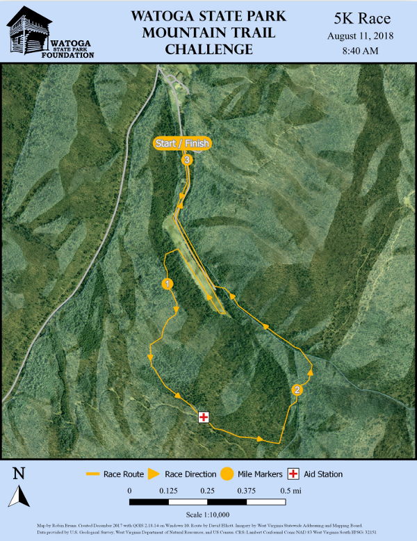
The 5K race route starts near the Beaver Creek Campground check-in building. The first mile along the campground road and down to the end of the grassy airstrip feels nearly flat, gaining only 80 feet to the end of the airstrip and then descending 40 feet on the way back to where it turns west into the woods and heads up a ridge through hardwoods and pines. It climbs at a moderate rate about 270 feet to a wildlife feed lot where there is an aid station. This is the high point of the course. From there it’s downhill through hardwoods, then hemlocks, then pines to a lovely stretch through rhododendrons along Beaver Creek. The course joins the Allegheny Trail to continue through rhododendrons and returns to the grassy airstrip – a cool finish for a 5K race in August.
Topo map and elevation graph give you one way of seeing the 5K route. Here are two more:
Interactive 3D Map (courtesy of Paul Low)